
Hiking Abel Tasman Coastal Track
Hiking the Abel Tasman Coastal Track in Abel Tasman National Park, New Zealand is a unique hiking experience, due to its unique hiking terrain.
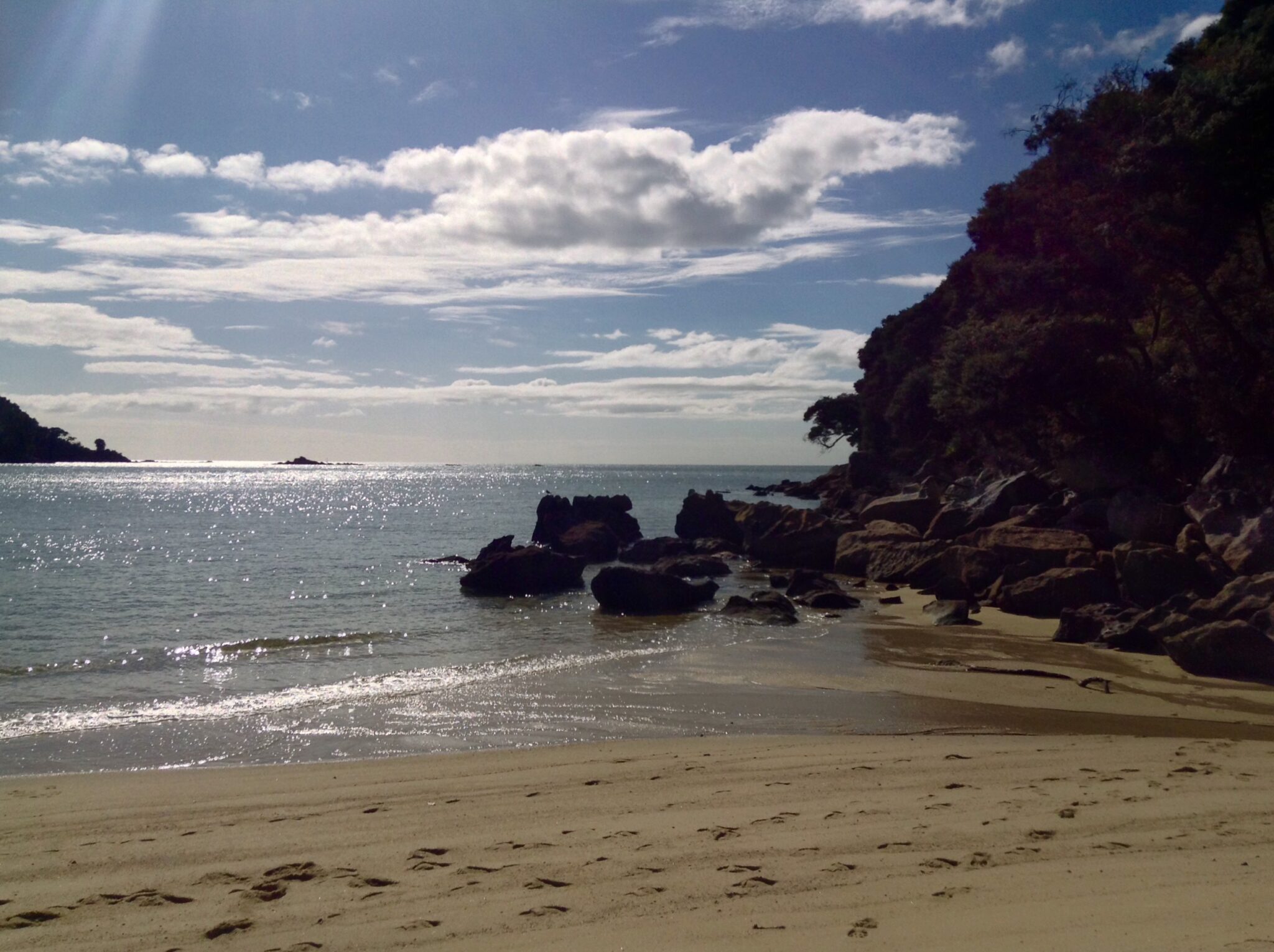
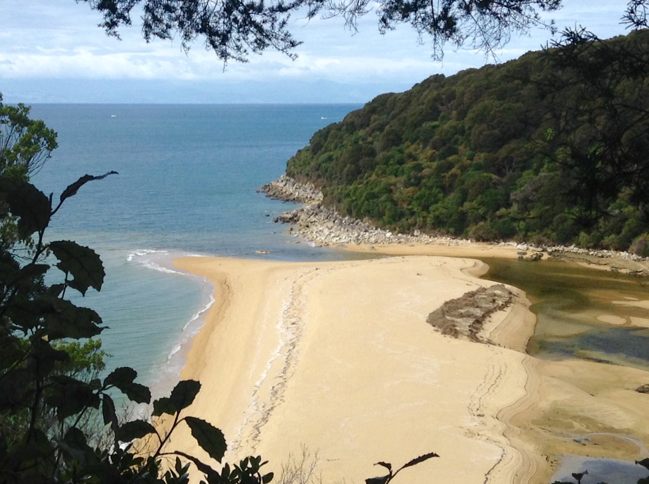
Instead of up and down mountains, this one-way hike alternates in and out of lush, fern-filled forests, onto beaches of golden sand, and through estuaries that change with the tide.
The track is managed by New Zealand’s Department Of Conservation (DOC) and is classified as another of New Zealand’s 10 “Great Walks”.

The DOC estimates walking the entirety of this 37 mile (60 km), one way track, to take 3-5 days. As it’s a one way track, you either need to double back, or hire a water taxi, or sea shuttle (info below), to return. This complicates things, but allows flexibility in selecting parts of the track to hike.
As it’s difficult to understand where all the key areas are from information found on-line, I’ve developed this post to show you where some of the key highlights and secret places are, so you can make a better decision on which section(s) to hike.
How To Get To Abel Tasman Track
By Car
Marahau, on the southern end of the trail is Abel Tasman Coastal Track’s main access point. There is also access to the northern side of the track via Golden Bay, to Totaranui, Awaroa, and Wainui.
By Bus
The Intercity Bus makes regular stops to Marahau from Nelson, which is 40 miles (64 km) away. Furthermore, due to lodging availability and regular bus service, Nelson is a good place to stay prior to your trip. It’s also a good place to stock up on groceries, for snacks or meals, as no food is available on the track.
Abel Tasman Huts & Campsites
Booking Huts & Campsites
As this track gets busy, especially in peak season, you need to book huts and campsites well in advance. You can’t just wild camp. In fact, to stop people from doing this, rangers along the trail will likely ask to see your booking documents and ID.
There are so many huts and campsites along the route, it’s best to access the details here. First, however, you need to decide which section(s) of track you want to hike.
Facilities
You cannot buy food on the track and there are no cooking facilities in the huts. Therefore, if you bring something that needs heated, you need to bring your own portable stove and fuel.
There are also no lights in the huts, so remember to bring a flashlight or head torch.
Also, although some facilities have filtered drinking water, it’s wise to bring your own water filtration system, just in case it goes down.
Surprisingly, there is limited wifi, but don’t plan on relying on this.
For a more comprehensive list of things you need, click here.
One final note, when I was here, there were a ton of pesky sand fleas. These guys love me, so I had red welts for about a week after my visit. If you’re sensitive to them, bring bug repellent!
Abel Tasman Coastal Track App
As there’s limited wifi in Abel Tasman Track, you can download the Abel Tasman App for up-to-date information on the track, weather, and tide levels. The tidal levels are important as you will need to adjust your route during high tide.
The app also has geolocation, showing you where you are, which is super convenient.
Abel Tasman Coastal Track Map
I’ve posted a copy of the New Zealand Department of Conservation (DOC) map here for reference purposes of this post. However, it’s always best to access it directly from the DOC, in case there are updates, warnings, or closures.

Getting Around In the Park
Although most people walk the Abel Tasman Coastal Track, there are several other options. In addition, you can also combine transportation methods, making this unique track very flexible.
Water Taxis & Sea Shuttles
Water taxis and sea shuttles are available at various points, allowing you to start/finish at multiple locations along the trail.
For example, you can hike from one end of the track and return to your origin via water taxi, or you can take a water taxi to a designated point, or points, and hike back.
Kayaks
You can rent kayaks aong the coast. You must, however, be a seasoned kayaker, due to currents and conditions. For this reason, you also cannot kayak solo. Kayaks are also not recommended above Onetahuti, as conditions are more exposed.
Other Options
You can also book scenic flights, take catamarans, ride horses (although not directly on the track), and a variety of other options. This DOC website lists approved transportation companies.
Landmarks and Distances
According to the DOC the main landmarks, with distances and times are:
- Marahau to Anchorage Hut – 7.7 miles (12.4 km), 4 hours
- Anchorage Hut to Bark Bay
- High Tide – 7.1. miles (11.5 km), 4 hours
- Low Tide – 5.2 miles (8.4 km), 3 hours
- Bark Bay to Onetahuti
- High Tide – 4 miles (6.4 km), 2 hours
- Low Tide – 2.8 miles (4.6 km), 1 hour 45 minutes
- Onetahuti to Awaroa – 4.4 miles (7.1 km), 2.5 hours
- Awaroa to Totaranui – 4.4 miles (7.1 km), 2.5 hours
- Totaranui to Whariwharangi – 6 miles (9.8 km), 3 hours
- Whariwharangi to Wainui – 3.5 miles (5.7 km), 2 hours
Note: as the track is relatively easy, I’ve found these times to be very generous. On the flip side, make sure you add in time for any side trips you want to see.
Scenic Sights, Side Tracks, & Hidden Gems
These are just a few of the beautiful sites and side tracks you can take. They are noted south to a north.
Split Apple Rock (Toka Ngawhā)
Named ‘Split Apple Rock’ as it literally looks like a giants split apple.
It’s Maori name is Toka Ngawhā, and as with many beautiful features in New Zealand, there is a legend behind it. The legend is that the rock was split during a battle between the God of the sea and the God of land. Each trying to claim it as their own, as it’s positioned between the two.

This feature is near the beach at Kaiteriteri, south of Marahua. If driving, you can park near the beach and walk towards it. There are also organized kayak and boat tours to see it.
Cleopatra’s Pool
This cool little hidden gem is about a 2 hour return from Anchorage. Not only can you swim here, but the rocks double as moss-lined water slides.
Note that the track to get here crosses a river that has no bridge, so you will need to scramble over rocks. Be cautious as they can be slippery when wet.

Elephant Rock (or Kiwi Rock)
Watering Cove has some interesting rock formations, including a rock that looks like an elephant’s head. It’s also sometimes called Kiwi Rock as it also looks like the rare, native kiwi bird.
Watering Cove is before Anchorage Hut.

Te Puketa Bay
There is a track from Anchorage that leads up Pitt Head and Te Puketa Bay to an ancient Maori Fort (pa) site. The track takes about 1.5 hours.
Falls River Track
More secluded swimming spots can be found along Falls River Track, which starts near Torrent Bay.
The track also includes traversing along the 154’ (47 m) swing bridge (below) over Falls River. This is about a 3 hour return.

Cascade Falls
This beautiful falls area is 1.5 hours from Torrent Bay. It’s a steep walk to the top, but worth it.

Tonga Island Marine Preserve
This preserve is a protected habitat for fish, shellfish, birds, penguins, and seals. You can kayak out here to watch the animal life.

Awaroa Inlet
You may have heard about Awaroa back in 2016. It was in the news after New Zealanders purchased it from a private owner after raising 2 million dollars on a crowdsourcing site.
They then ceded it to the National Park to ensure that this beautiful area remained accessible to everyone!

The other thing that’s unique about this area is that it’s the only part of the track that is only accessible around low tide (1 hour 30 minutes before and 2 hours after). Therefore, you need to plan your crossing here. Other areas like this have alternative routes.
Also, because the water is shallow, it’s also warmer, making it a good place for children to swim.
Quieter Beaches
Mostly due to the logistics of distance, the beaches on the northernmost end of the track will likely have the fewest tourists. Wainui, But Mutton Cove, and Anapai are beautiful beaches with fewer people.

My Trip
This was my last stop after a month in New Zealand, so I only spent one day here. There‘s so much to see in New Zealand, even a month is not enough!
For my visit, I stayed overnight in Nelson and took the Intercity Bus to Marahau early the next morning. I pre-booked a sea shuttle from Marahau to Bark Bay. From there, I hiked south, back to Marahau.
Even after all this, I was still able to catch the late afternoon bus back to Nelson.

Want More of New Zealand?
The scenery along the Abel Tasman Coastal Track is beautiful, and I wish I had time to see some of the other areas. That said, however, I personally favor mountain hiking, or at least higher elevation hiking, so three days here would have been too long for me. I think two days (one night) would have been the perfect balance for me.
For other great hikes in New Zealand, see my posts on Routeburn Track, Tongariro, and Cape Brett Walkway. And if you’re on the South Island, you can’t miss stunning Queenstown, Franz Josef Glacier, Milford Sound, and the wineries of Marlborough.
To help plan your trip, check out my New Zealand Travel Guide, to learn more about the top destinations, how to get around, when to visit, safety tips, and more.
Julie
Hello! I resigned from a corporate career in product development to explore the world. Although my goal was to travel for a year, 8 years later, I’ve been honored to have explored more than 60 gorgeous countries and met some unbelievably amazing people. Our world truly is a beautiful place! Follow me into the gorgeous unknown by subscribing below. You’ll receive details on fabulous destinations, comprehensive travel guides, travel tips and tidbits, and information on travel trends, like experiential, sustainable, and transformational travel. Where is your next gorgeous unknown? Julie


2 Comments
Kerry Dare
What a beautiful country. The last areas with the mountains, lakes and streams are my favorite. You have sold me with your post card photos. I want to go to NZ now. It looks like hiking the country is the best way to see it. Well the wine country too, of course.
The Lovely Ann and I are looking forward to your next adventure
Thank you again for sharing.
juliedecocker@yahoo.com
Kerry, the hiking is awesome, but you might want to think about riding a motorcycle here. It would be a lot more work than sitting on a bus, but I think it would be a great way to get around too.